Broadband Experiment Across the Alaska Range (BEAAR), Central Alaska

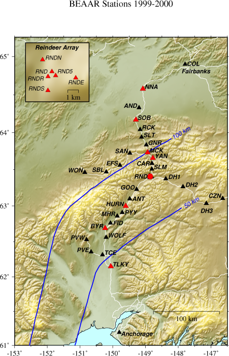
The Broadband Experiment Across the Alaska Range is a PASSCAL seismic experiment in which 36 stations are deployed across central Alaska. Beginning the summer of 1999 and continuing on through the summer of 2001, the BEAAR project is designed to determine lithospheric structure beneath central Alaska by recording local, regional, and teleseismic events. Specifically, the orientation of the network spans the Alaska Range, which includes North America's highest peak, Denali, and is positioned to determine upper mantle and crustal structure beneath this range. The southern Alaska boundary is a compressional environment between the Pacific (oceanic) and North American (continental) plates, creating a subduction zone.  This is work done with Dr. Geoff Abers (more info here).

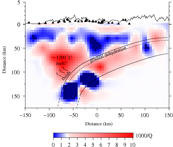
akrefmap We used P and S wave attenuation (Q) from local earthquakes in central Alaska as a proxy for temperature in the mantle wedge. This is a region of active subduction and high seismicity rates, yet there has been no significant volcanism in the Alaska Range, which contains some of the highest topography in North America. The shallowest part of the wedge shows little attenuation, as expected for a cold viscous nose that is not involved in wedge corner flow. Overall, the spatial pattern of Q beneath Alaska is qualitatively similar to other subduction zones, although the highest wedge attenuation is about a factor of 2 lower. The Q values imply that temperatures exceed 1200°C in the wedge, on the basis of recent laboratory-based calibrations for dry peridotite. These temperatures are 100–150°C colder than we infer beneath Japan or the Andes, possibly explaining the absence of arc volcanism in central Alaska.

attenuation cross section


Stachnik, J.C, G.A. Abers, and D. H. Christensen (2004), Seismic Attenuation and mantle wedge temperatures in the Alaska subduction zone, JGR, 109, B10304